The most recent outing of the Walking Club took place on Thursday, September 26. We took the subway to Union Station and the Bay St. bus down to the waterfront. The aim was to walk along Queen’s Quay East as far as Cherry St., observing the huge developments that have taken place along Queen’s Quay, and to take in the enormous changes happening in what is referred to as “The Portlands”.
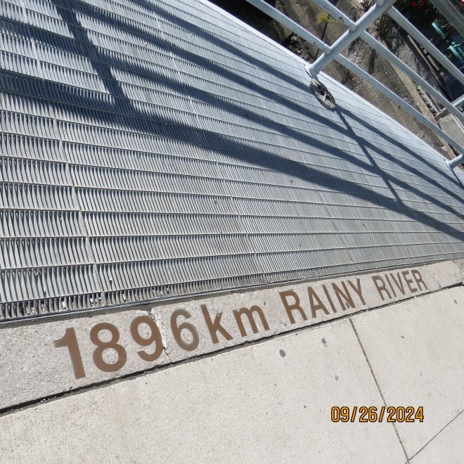
At the foot of Yonge St., there is a mosaic depicting the cities that Yonge St. reaches on its way to Rainy River in northwestern Ontario. I couldn’t capture them all but here is one:
When it opened, the Toronto Star building (at left in the next photo) was the tallest by far along Queen’s Quay East. It is now being dwarfed by 70-80 storey condos being built nearby. I wouldn’t be surprised to see the former Star building torn down and replaced by something grander, if not better.
At the foot of Yonge St. sits a work of art that reminds me of a giant egg beater.

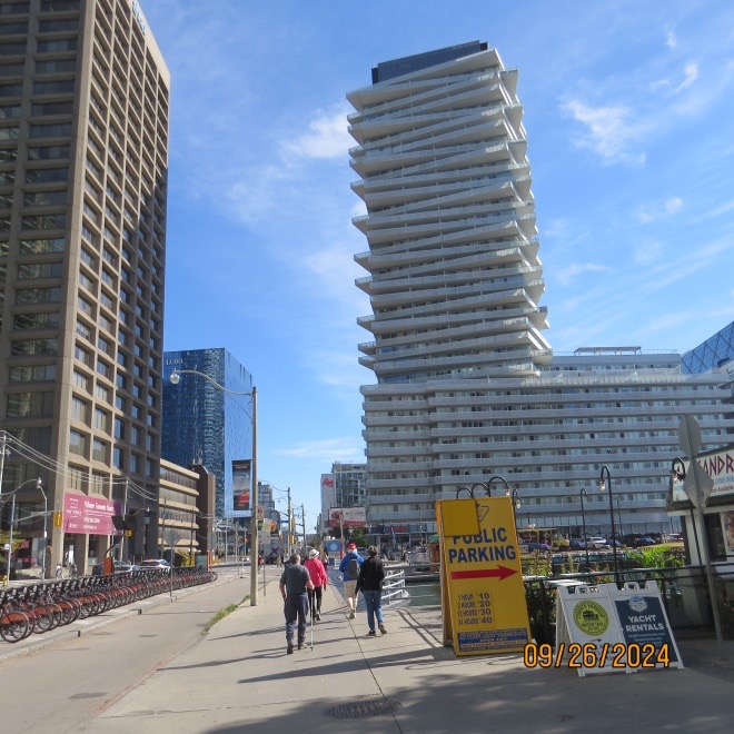
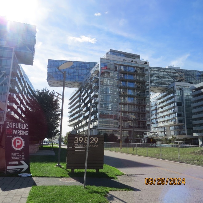
Queen’s Quay has become a hot spot for condo development because of its location beside the lake. Many new and innovative designs are found here:

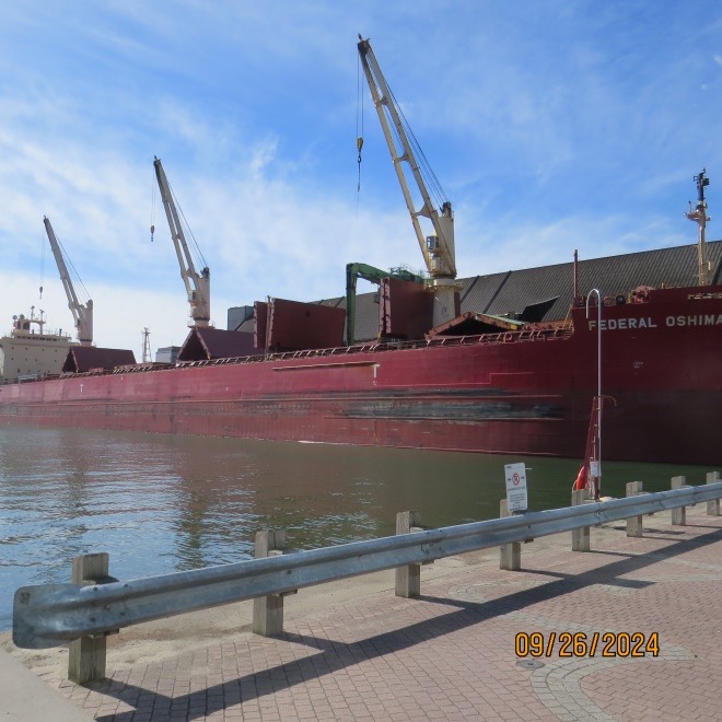
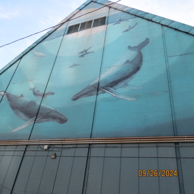
Further east, we came upon the Redpath Sugar refinery, still in business, with a large ship unloading raw sugar to be refined.
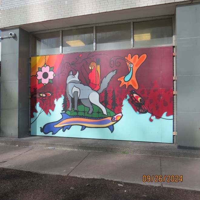
There were some examples of Indigenous art on the windows.
The refinery has a huge whale mural facing the street.
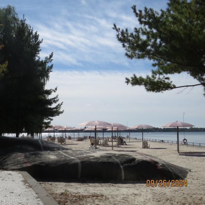
Across the slip from Redpath is the appropriately named Sugar Beach. You can’t swim there but there is sand and many chairs with umbrellas.
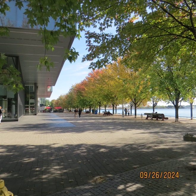
Continuing along the water’s edge, Corus Quay leads past Corus entertainment head offices (Global TV) some of George Brown College’s facilities, and some restaurants. The city has done a remarkable job making this a beautiful lakeside promenade.
More condos have been built in this area, based on the city providing a waterfront LRT; however, there is no funding for the LRT so buses are in service.

East of this area is still a kind of wasteland but there is much construction activity where Google was going to build the city of the future. However, the city backed out and the project was cancelled. Nevertheless, this area will soon be a desirable address by the lake.
Before we got to Cherry St., we arrived at the new Cherry St. The old one has been blocked off just below Lake Shore Blvd. where there was a swing bridge, so to go south we had to take the new Cherry St. The city has installed new bridges to go over the Keating Channel and, further down the street, over the new bed for the Don River. The Keating Channel was created about a century ago when the area was swamp and was filled in to expand the port facilities. The Don River was rerouted via the Keating Channel into Lake Ontario. The recent construction has extended the flow of the Don south through the port lands to a new outlet into the lake.
Here you will see the first set of bridges:
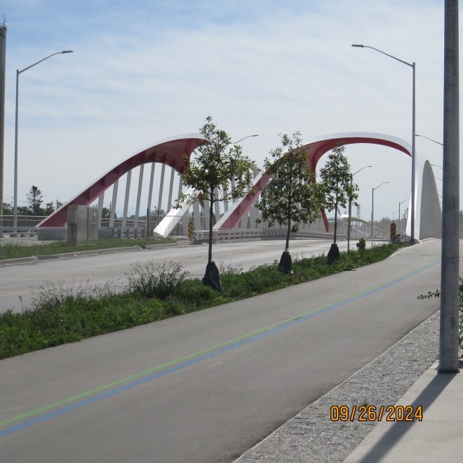
Note the landscaping and the bike lanes.
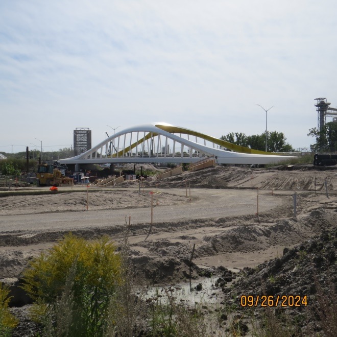
About a kilometer further south, the road crosses the new Don River with another bridge. These bridges were constructed in Europe and shipped across the Atlantic Ocean to the city.
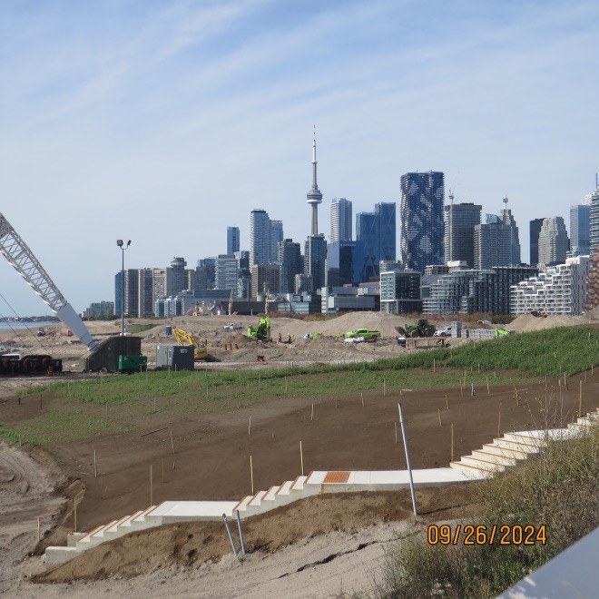
From the second bridge, you can see the large crane that was installed with much fanfare when the St. Lawrence Seaway was opened. Toronto hoped to become a great lake port and needed this giant crane to unload all the ships that were expected. It now sits isolated as all the warehouses and piers around it are gone and replaced with open parks.
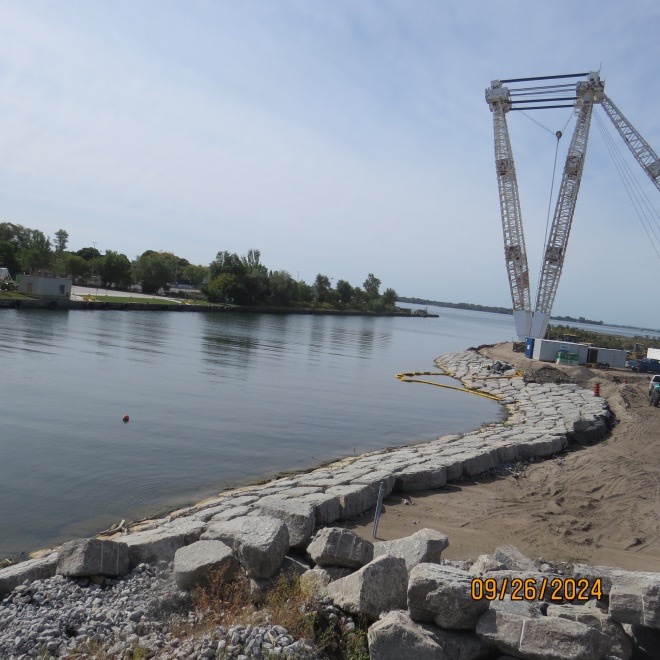
From here you can also get a different view of the city skyline and the massive mounds of earth that are being moved around.
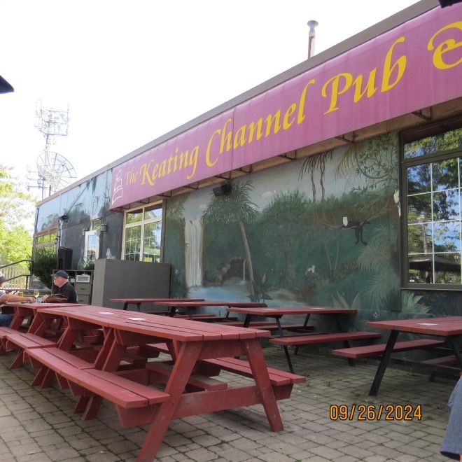
By the time we reached the second bridge, we had been walking for over an hour and a half, so we decided to have lunch at one of our favourite pubs, the Keating Channel pub on old Cherry St. which now finds itself on an island as the new Don River cuts it off from the rest of the port lands.
Note: This is the last edition of James’s Walks for a while. The Walking Club is taking a break until March when I hope it can be reinvigorated with reliable commitment from its members.
